Could online maps save coral reefs?(CNN) -- You used to know them as maps, but in a Web 2.0 world they're now called geographic information systems (GIS) and they could play a key part in saving the world's endangered coral reefs.
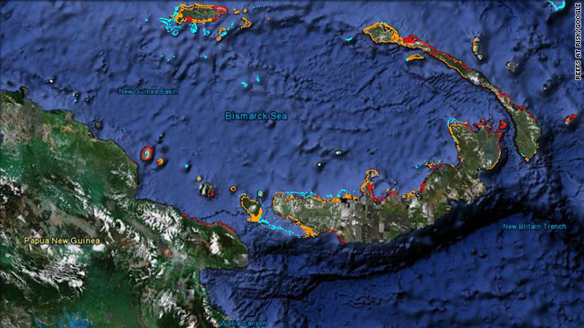
Harnessing the power of interactive maps is Reefs at Risk Revisited, a conservation and research project headed by the World Resources Institute. It is in the process of updating its 1998 survey on the threats to the world's coral reefs and central to the project is Google Earth.
The online map is being used to collect data from nearly 30 project partners, including WWF and Conservation International, and the final report will be freely available to the public.
People will be able to zoom around the world as they normally would, but instead of "flying" from their house to Pyongyang they will be able to almost literally dive into the reefs and discover the pressures on some of the world's most delicate marine ecosystems.